Wild kayak-canoe tours in Szigetköz
The nearly 400 km2 area of Szigetköz is a wetland habitat of exceptional importance, where extremely diverse habitats have developed as a result of the interplay of the unique geomorphological, climatic, soil and water management characteristics. These features provide a home for a rich and diverse wildlife, which you can discover on wild kayak and canoe tours!
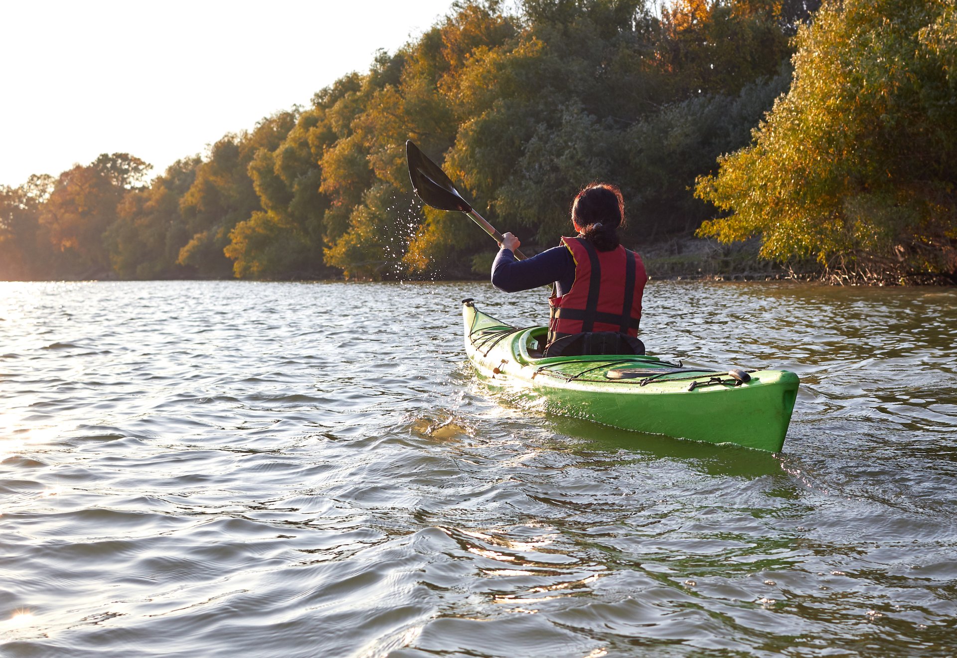
Let's explore the natural treasures of Szigetköz on kayak and canoe tours
The name Szigetköz refers to the area bordered by the main Danube (Old-Danube) and the Mosoni-Danube, coming through the Dévény Gate and splitting into several branches. This area is a north-west, south-east, elongated, average 6-8 km wide and approximately 52 km long young Danube alluvial cone. The size of the area is about 375 square kilometers. Basically, it can be divided into two parts, upper and lower. The Szigetköz includes the largest island of our country and forms the largest tributary system of the Danube in Hungary.In the branch system, which covers a hundred square kilometers, there are many smaller and larger islands, where nearly 400 kilometers of winding Danube branches stretch, which means that we can take part in wonderful water tours here.
The names of the branch systems:
• Rajkai-ágrendszer
• Tejfalu(s)i-ágrendszer
• Cikolai-ágrendszer
• Kisbodaki-ágrendszer
• Dunaremetei – (Lipóti) ágrendszer
• Ásványráró-ágrendszer
• Bagaméri-ágrendszer
• Patkányosi-ágrendszer
About water hiking in Szigetköz, in general
Water hiking in the Szigetköz and Csallóköz branch systems is only recommended for experienced hikers with local knowledge or with tour guides. The branch systems are complicated, roaring, suddenly accelerating water courses, sharp bends, undulating, swirling waters under bridges (even wild waters of WW-I, WW-II) are common. The water of a larger branch system can meander for up to 30-40 kilometers between its islands, so those who do not know the area well can easily get lost.It is worth looking for accommodation from which the starting points of the water tours are easily accessible. Regia Panzó is one of the best choices for this very reason, as it is located on the banks of the Danube in Halászi, at the gate of Szigetköz.
Contact us at our contact details below if you want to book a room!
But let's see which are the best hiking routes:
1. Rajkai tributary system - Rajkai-mellékágrendszer
The Aranykárász campsite is the starting point for water tours of the Mosoni-Danube and its tributaries. Two circuit routes are available, the longer one also leads to the Tejfalusi branch system.
Route: Szivárgó channel – SZ1 water intake sluice – Sand fish ladder – Szigetparti branch – back at Dunakiliti on the Szivárgó channel
We recommend this tour with a tour guide, especially for experienced hikers.
2. Tejfalusi branch system - Tejfalusi-mellékágrendszer
One of the exceptionally large and popular branch systems of the Felső-Szigetköz. Its central settlement is Dunakiliti, but the branch system is located approximately 3 km from the village.
In the Tejfalusi branch system, there are many hiking trails of varying difficulty, but due to the challenges in the water area, it is worth using a hiking guide from the campsite or joining an organized tour. During the permitted period, the Helena and Ördögsziget lakes are easily accessible from here, which are special on the island due to their population of freshwater jellyfish.
3. Cikolai branch system - Cikolai-ágrendszer
Another popular resting place in the Upper Szigetköz is the Cikolai branch system. This is the largest branch system in Szigetköz, so it offers the most hiking trails. Its central settlement is Dunasziget.
Here too, it is worth going with a tour guide or joining an organized tour, but close to the coast you can also explore the area on your own on smaller tours, of course with the help of a map and consultation. A good destination can be the Denkpáli fish ladder, where the narrow branches in the north (Barkás, Kerekesciglés, etc.) offer a pleasant view.
4. Kisbodaki branch system - Kisbodaki-ágrendszer
Based on the size of the Kisbodaki tributary system, it belongs to the smaller tributary systems, but it is a unique water area in many respects. In this area is the largest and arguably the most beautiful "floodland forest" of the Szigetköz (geographically it is not, but it looks exactly like it), Öreg-Szigeti-tó. This is an ideal and convenient starting point for water tours of the Csallóközi branch system, and for those who like silence and closeness to nature, it is simply an essential destination!
With the help of a map, you can take an excellent tour around Öreg-Szigeti-tó, even without a guide, which you can visit without restrictions from June 15.
5. Mineral chewing branch system - Ásványrágói-ágrendszer
Ásványráró is the largest settlement in Alsó-Szigetköz and the most popular tourist destination. The administrative area of the settlement is huge, it is part of two branch systems, the Ásványrárói and the Bagaméri, thus the largest water surface in Szigetköz belongs to it.
The number of available hiking trails exceeds 10. A popular destination for water tours is the Ásványrárói branch end closure, which shows the diverted Old Danube through its magnificent panorama. From Ásványráró, you can easily row across to Csallóköz, or if you like challenges, you can take the Bagaméri tour, intended for sporty hikers, touching the Old Danube, but we only recommend a tour guide for this.